Devon · PL1-PL9
Drone mapping services in Plymouth
The largest city in the coverage area, where the work is centre and waterfront regeneration, and the naval base restricts airspace over part of it.
Regeneration at a scale nothing else here matches
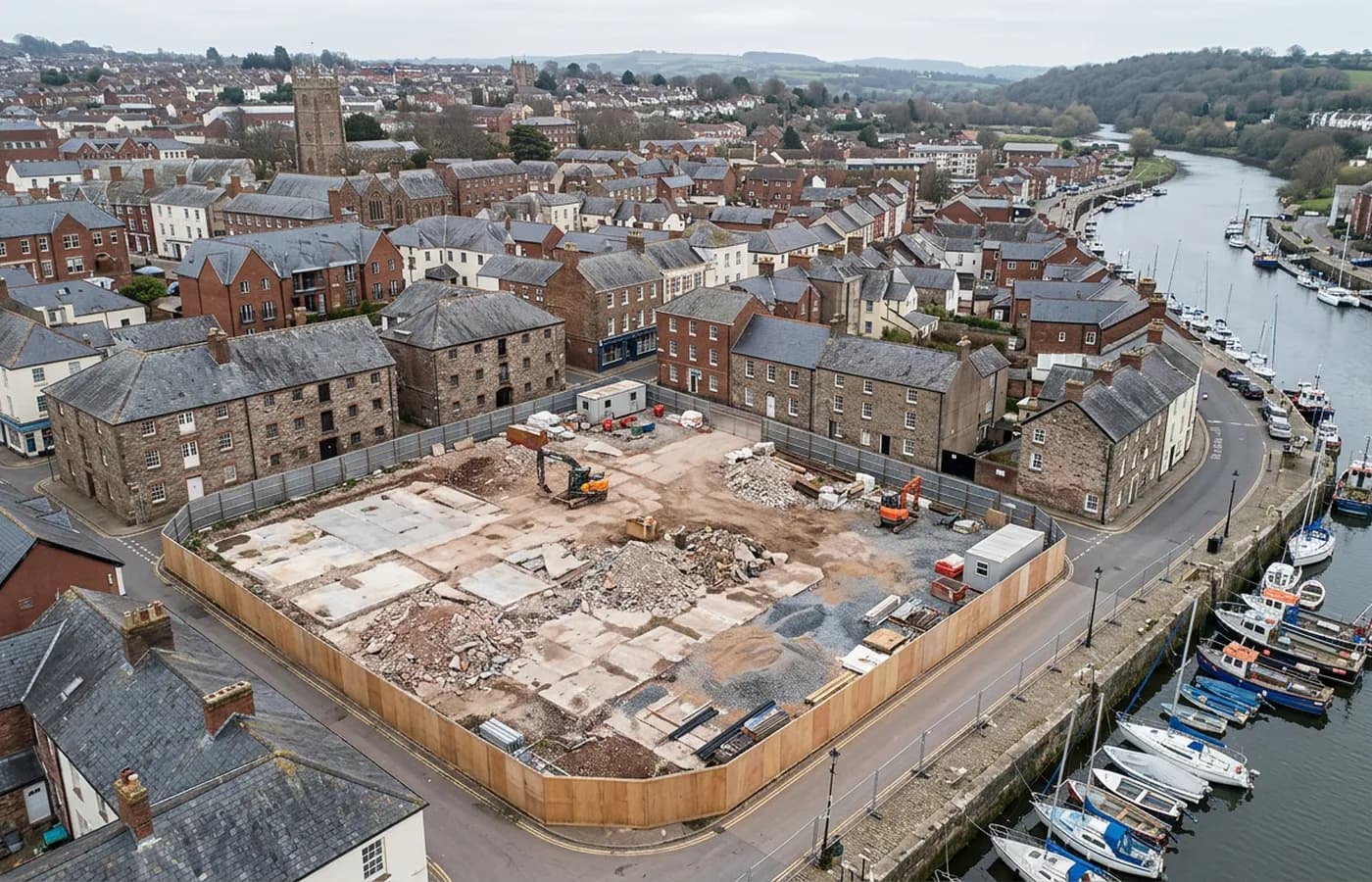
Plymouth's development work is concentrated in the rebuilt post-war centre, the waterfront and the northern edge, and the scale of it is different from anywhere else in this coverage area. Large city blocks come forward whole, often with substantial existing structures on them, and the design work starts from what is standing rather than from an empty field.
That makes existing conditions capture the most common commission here: a model of a block, its levels, its boundaries and its relationship with the streets around it, rather than a topographic survey of open ground.
The naval base and the airspace over the city
The dockyard and naval facilities on the Tamar carry their own airspace restriction, and it is not negotiable or approximate. Any job on that side of the city is checked against it in detail before anything is agreed, and some sites simply cannot be flown.
Saying so early is part of the service. A client is better served by a clear no on a specific plot than by an operator who turns up, finds out on the day and bills for the visit.
Limestone, water and a city built on a slope
The city sits on limestone between two river mouths, with hard ground, real height change between the centre and the waterfront, and a great deal of coastline inside the built up area. Waterfront sites bring the same tidal timing question as everywhere else in this coverage area, and quay walls need angled capture rather than a plan grid.
The compensation is that hard, dry, well-drained ground behaves well in a photogrammetric process. There is far less standing water on a Plymouth site than on the low ground of the Somerset levels or the Axe valley.
Working in a dense city
Uninvolved people are the normal condition of a job here rather than the exception, and that governs where and when a flight happens. Early morning is often the only sensible window for a central block, and a managed working area is standard.
Plymouth is about an hour from base down the A38, which is at the outer end of a comfortable single visit, so a job here is usually planned as a proper morning rather than squeezed between two others.
Flat roofs, and the city rebuilt above them
The rebuilt post-war centre is largely flat-roofed commercial blocks, and flat roofs are one of the most useful things a drone looks at for an owner or a managing agent. Nobody goes up there routinely, plant and equipment accumulate, drainage outlets block, and the extent of what is actually on a roof is often unknown.
A straight down capture of a city block records all of it in one pass: outlets, plant, upstands, previous repairs, and the true extent of each roof against the others around it. On a site where a building is being reworked, that pairs naturally with a model of the elevations from the same visit.
The waterfront heritage estates at Royal William Yard and around Sutton Harbour are the other significant subject. Large, listed, and closely built, they need model capture rather than mapping, flown at close standoff around each block, and they carry the tidal timing question wherever a quay wall or a slipway is part of the job.
Behind the survey
What is behind a Plymouth mapping flight
CAA registered operator
Operator ID and Flyer ID held, which is the baseline anyone commissioning a flight over a live site should be asking to see before anything takes off.
A2 Certificate of Competency
The qualification that covers flying closer to people and property than the open default allows, which is what a built up site or a town centre survey needs.
100 megapixel Hasselblad camera
On a DJI Mavic 4 Pro. Resolution is the whole argument on a mapping job: it decides whether a stitched site map shows a plot peg or a smudge.
Radiometric thermal camera
A DJI Mavic 2 Enterprise Advanced with a 640 by 512 thermal sensor, for the jobs where a site needs a heat reading alongside the map.
Insured with Coverdrone
Full commercial cover. Certificates go to your site team or your client before the visit if that is part of your process.
Written note within 48 hours
Every job comes with a written record of conditions, coverage and the limits of the data, not just a folder of files with no explanation attached.
Construction background
The surveyor came into this from building work rather than from photography, so a site brief about levels, access and programme lands without translation.
Nearby
Also covered around Plymouth
- SaltashThe Tamar crossing town, where two nationally significant bridges, a trunk road and the Cornish edge of the estuary set the survey agenda.
- IvybridgeA commuter town on the A38 under the southern edge of Dartmoor, near the china clay country, where extraction and steep valley ground dominate the work.
See the output formats
Request a mapping quote in Plymouth
Send the boundary and what the data is for. Sam Hembury will come back with a fixed price for the site and the next slot the weather suits.