Devon · PL21
Drone mapping services in Ivybridge
A commuter town on the A38 under the southern edge of Dartmoor, near the china clay country, where extraction and steep valley ground dominate the work.
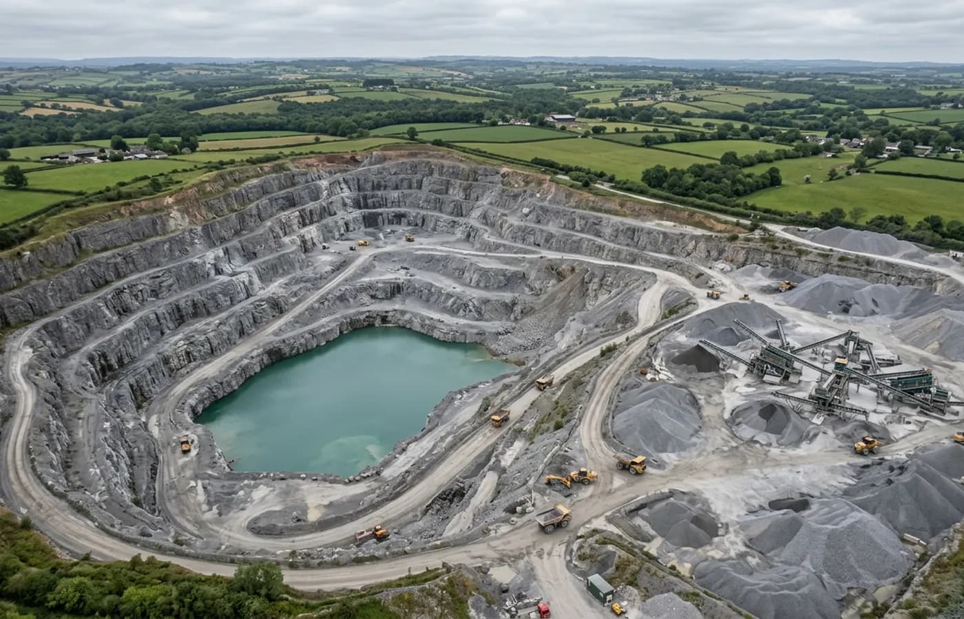
China clay country to the north
The high ground north of Ivybridge carries one of the largest worked landscapes in the South West, where extraction, tips, settling pits and restoration have been reshaping the moor edge for generations. Ground like that is measured rather than looked at: material moved, faces advanced, tips regraded, water managed.
Repeat capture is the natural fit. A single map of a working landscape is a snapshot with limited value; the same site flown at intervals, processed identically, is a running quantity that anyone can check.
The Erme valley and hard relief
The town itself sits in a steep river valley with the ground rising sharply to the moor. Height change of that order changes the flight plan: a fixed height grid flown from the valley floor is far too high over the shoulders of the valley and far too low over the bottom, so a survey is flown in terraces or with terrain-following planning.
Wooded valley sides are the other feature. Mature tree cover along the Erme means the ground beneath it is inferred rather than measured, and on a site with a wooded boundary the note names exactly which parts of the terrain surface are estimated.
The trunk road and its constraints
The A38 runs along the southern edge of the town and much of the employment land relates to it. Highway margins, junctions and access work all generate corridor survey requirements, flown as strips along the alignment with the extra overlap that strip processing needs.
Flying near a live trunk road brings its own operational considerations, mostly about where the aircraft can be and where the operator stands, and those are worked out on a site visit rather than assumed from a map.
Moor edge weather
Weather here follows the moor rather than the coast. Cloud sitting on the high ground stops a flight over the tips even when the town below is clear, and rainfall on this side of Dartmoor is high enough that ground conditions on unmade sites lag the forecast by days.
Ivybridge is around forty minutes from base along the A38. For moor-edge and extraction work it is worth agreeing a target week rather than a fixed morning, and for a job in the town itself a fixed date is usually fine.
A commuter town of one generation, now infilling
Most of Ivybridge went up between the 1970s and the 1990s, which gives it something few Devon towns have: a large, consistent housing stock of one era, laid out with generous spacing. Land within those layouts now comes forward for infill, and infill plots inside an existing estate are almost always about levels and boundaries.
Those are exactly the questions an aerial survey answers well. Where a garden ends, what the ground does between two houses, how a proposed access ties into a road that was built to a different standard. The awkward part is that the surrounding property is occupied, so the flight is planned around people who did not commission it.
The viaduct and the old rail alignment running through the valley are the other recurring subject here, and structures of that kind are recorded from angles rather than from above. A tall stone structure in a wooded valley is one of the harder things to model well, and it takes several passes at different heights to do properly.
Behind the survey
What is behind a Ivybridge mapping flight
CAA registered operator
Operator ID and Flyer ID held, which is the baseline anyone commissioning a flight over a live site should be asking to see before anything takes off.
A2 Certificate of Competency
The qualification that covers flying closer to people and property than the open default allows, which is what a built up site or a town centre survey needs.
100 megapixel Hasselblad camera
On a DJI Mavic 4 Pro. Resolution is the whole argument on a mapping job: it decides whether a stitched site map shows a plot peg or a smudge.
Radiometric thermal camera
A DJI Mavic 2 Enterprise Advanced with a 640 by 512 thermal sensor, for the jobs where a site needs a heat reading alongside the map.
Insured with Coverdrone
Full commercial cover. Certificates go to your site team or your client before the visit if that is part of your process.
Written note within 48 hours
Every job comes with a written record of conditions, coverage and the limits of the data, not just a folder of files with no explanation attached.
Construction background
The surveyor came into this from building work rather than from photography, so a site brief about levels, access and programme lands without translation.
Nearby
Also covered around Ivybridge
- PlymouthThe largest city in the coverage area, where the work is centre and waterfront regeneration, and the naval base restricts airspace over part of it.
- TotnesA steep town on the tidal Dart with a long-running brownfield regeneration at its centre, where the questions are levels, structures and river access.
See the output formats
Request a mapping quote in Ivybridge
Send the boundary and what the data is for. Sam Hembury will come back with a fixed price for the site and the next slot the weather suits.