Drone Mapping Services
Orthomosaic site mapping
A single scaled, geo-referenced image of the whole site, stitched from a flight grid, ready to draw over in CAD or drop into a GIS.
Not sure which files you need? Every output this produces is listed here, with what each one is for and what it does not measure.
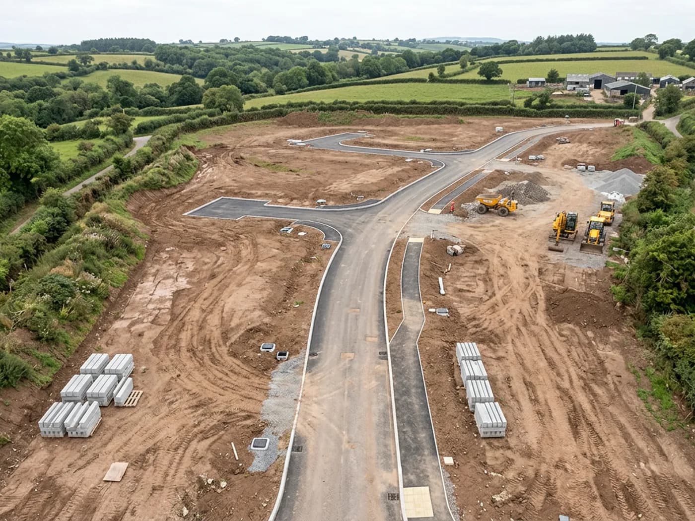
An orthomosaic is what most people picture when they ask for a site map from the air. Hundreds of overlapping photographs are flown in a grid, then processed into one image with the lens distortion and the perspective taken out, so that a distance measured across the middle of the picture means the same thing as a distance measured at the edge. That is the part an ordinary aerial photograph cannot do.
The result is a background you can work on top of. Boundaries, kerb lines, gullies, hedge banks, existing buildings, hardstanding, tracks and plot pegs all sit in the right place relative to each other, at a resolution close enough to see the detail you would otherwise be walking the site to confirm.
It is delivered geo-referenced, in the coordinate system you ask for, with a world file so it lands in the right place when you bring it into your own software rather than needing to be dragged and scaled by eye.
What is included
- Flight planning for the site, including airspace checks and landowner or site access arrangements
- A gridded flight with the overlap the processing needs, flown in one visit where the site and the weather allow
- Processed orthomosaic supplied as a geo-referenced GeoTIFF, with a JPEG or PNG copy for presentations
- A scaled PDF plan of the site at a sheet size that suits the drawing
- The raw imagery kept on file, so a later output can be produced without flying again
- A short written note on conditions, coverage and anything the data does not show, within 48 hours
What a mapping flight will not do
A photogrammetric map records surfaces the camera can see. Ground under a dense tree canopy, under a building, inside a culvert or below standing water is not in the data, and no amount of processing puts it there. Where a site has heavy cover, those areas need a person on the ground with a level or a total station, and the note that comes with the files says which areas they are.
Accuracy is the other place to be plain. Positioning from the aircraft alone puts a site in roughly the right place on the map, which is fine for planning drawings, feasibility work and progress records. If a drawing has to be relied on for setting out, for a boundary dispute or for a formal topographic survey, that needs surveyed control points, established by a land surveyor, that the flight can then be tied to. We fly to control other people set, we do not certify it.
Why the resolution matters more than the drone
The camera doing the work is a 100 megapixel Hasselblad on a Mavic 4 Pro. On a site map that resolution is the difference between a picture of a field and a picture where you can count the plot pegs, read the line of an existing hedge bank and see which gullies have been formed.
It also means fewer passes for the same detail, which matters on a large site where a low, slow flight would otherwise take most of a day and still be flying into changing light.
On the day
How a site mapping runs
- Step 1
Site brief
You send the location, the red line boundary and what the map is for. That decides the flight height, the grid spacing and whether ground control is worth setting.
- Step 2
Airspace and access
Airspace is checked against the site, along with any restriction over it, and access is arranged with whoever controls the ground. Sites near an airport or a military airfield need this done before the day rather than on it.
- Step 3
The flight
The grid is flown automatically at a fixed height with the camera pointing straight down, plus a set of angled passes where the site has vertical faces worth capturing.
- Step 4
Processing
The imagery is aligned and stitched, tied to whatever control the job has, and exported to the formats agreed at the brief stage.
- Step 5
Handover
Files are sent by download link, with the written note on conditions and coverage inside 48 hours of the flight.
Behind the work
Kit, cover and qualifications
CAA registered operator
Operator ID and Flyer ID held, which is the baseline anyone commissioning a flight over a live site should be asking to see before anything takes off.
A2 Certificate of Competency
The qualification that covers flying closer to people and property than the open default allows, which is what a built up site or a town centre survey needs.
100 megapixel Hasselblad camera
On a DJI Mavic 4 Pro. Resolution is the whole argument on a mapping job: it decides whether a stitched site map shows a plot peg or a smudge.
Radiometric thermal camera
A DJI Mavic 2 Enterprise Advanced with a 640 by 512 thermal sensor, for the jobs where a site needs a heat reading alongside the map.
Insured with Coverdrone
Full commercial cover. Certificates go to your site team or your client before the visit if that is part of your process.
Written note within 48 hours
Every job comes with a written record of conditions, coverage and the limits of the data, not just a folder of files with no explanation attached.
Construction background
The surveyor came into this from building work rather than from photography, so a site brief about levels, access and programme lands without translation.
Site mapping
Orthomosaic site mapping questions
- Can you supply the map in British National Grid?
- Yes. Say which coordinate system you work in at the brief stage and the exports are produced in it. If you have surveyed control on site, the flight is tied to those points instead.
- How large a site can you cover in one visit?
- Most development sites, quarries and estate blocks around Exeter and the wider South West are a single visit. Very large or awkwardly shaped sites are flown in sections and stitched into one map afterwards, and we tell you at quoting stage which of the two your site is.
- Do you need us on site while you fly?
- Not usually, as long as access is arranged and anyone working there knows a flight is happening. On a live construction site we would rather have five minutes with whoever runs it before taking off.
Where
Orthomosaic site mapping across the South West
Also on this site
See the output formats
Request a mapping quote with Drone Mapping Services
Tell us the address and what you need looking at. Sam Hembury will come back with a fixed price and the next available slot.