Devon · EX5
Drone mapping services in Cranbrook
East Devon's new town, still building out phase by phase, which makes it the clearest case in the region for mapping a site repeatedly rather than once.
A town that has been a construction site since 2011
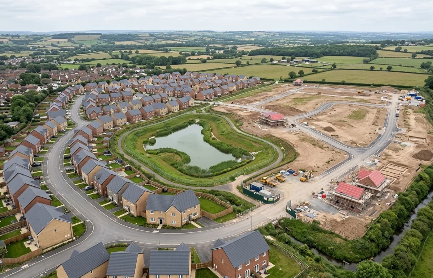
Cranbrook is the most obviously development-led place in this coverage area. Begun in 2011 on open farmland east of the Clyst valley, it has been growing outward in phases ever since, which means at any given moment part of it is finished streets, part is under construction and part is still a field with a red line round it.
That mixture is the reason it belongs on this list. Somewhere with all three states inside one boundary is exactly where a single dated orthomosaic earns its keep, because it settles what had actually been built and where by a particular week, which is a question that comes up repeatedly in phased delivery and is otherwise argued from memory.
Flat, open and easy to fly, which is rarer than it sounds
The ground here is a gently rolling farmland plateau with very little mature planting on the newer phases, and that combination produces good photogrammetry. There is no dense canopy to hide the ground under, few tall structures to cast long shadows across a formation level, and open sight lines for the pilot.
The flip side is wind. An open plateau with no hedgerow shelter on the working phases means the aircraft is exposed on days when a sheltered valley site would be flyable, and construction dust travels further across bare ground than it does on an enclosed site.
The airport is on the doorstep
Exeter Airport is immediately to the south west, along with Skypark and the science park, and that shapes every flight here. Airspace clearance is not a formality on this site, it is the first thing that gets sorted, and it is worth building a couple of days into the programme for it.
Once it is arranged, the flying itself is among the simplest in the coverage area. The awkward part of a Cranbrook job is upstream of the aircraft, not in the air.
Monitoring a site that changes every month
Where a town is being built continuously, comparing two dates is usually more valuable than a single map. Volumes moved between visits, plots handed over, roads adopted, drainage formed: all of it is easier to evidence from two processed surfaces than from a photograph and a diary.
For that comparison to hold, both flights have to be processed the same way and tied to the same reference, which is a decision made at the first visit rather than retrofitted at the fourth. On a site with this much repeat potential it is worth ten minutes at the brief stage.
The other Cranbrook-specific point is that the district heating network and the estate infrastructure were built as the town grew, so records of what went in when are spread across phases. A dated aerial record from a particular month is a cheap piece of evidence to have on file for exactly that reason.
Records of what went in, and when
A town built in a single continuous programme has a particular problem: everything under the ground went in during construction, and the record of it is spread across phases, contractors and years. The district heating network, the estate drainage and the service runs were all laid as the town grew outwards.
Aerial capture does not see buried services, and this site will not pretend otherwise. What it does give is a dated surface record of the moment before a road was surfaced or a plot was closed up, which is often the most useful thing anyone has when a question about position comes back years later.
Behind the survey
What is behind a Cranbrook mapping flight
CAA registered operator
Operator ID and Flyer ID held, which is the baseline anyone commissioning a flight over a live site should be asking to see before anything takes off.
A2 Certificate of Competency
The qualification that covers flying closer to people and property than the open default allows, which is what a built up site or a town centre survey needs.
100 megapixel Hasselblad camera
On a DJI Mavic 4 Pro. Resolution is the whole argument on a mapping job: it decides whether a stitched site map shows a plot peg or a smudge.
Radiometric thermal camera
A DJI Mavic 2 Enterprise Advanced with a 640 by 512 thermal sensor, for the jobs where a site needs a heat reading alongside the map.
Insured with Coverdrone
Full commercial cover. Certificates go to your site team or your client before the visit if that is part of your process.
Written note within 48 hours
Every job comes with a written record of conditions, coverage and the limits of the data, not just a folder of files with no explanation attached.
Construction background
The surveyor came into this from building work rather than from photography, so a site brief about levels, access and programme lands without translation.
Nearby
Also covered around Cranbrook
- ExeterThe busiest source of mapping work in the region, with land coming forward on every edge of the city and an airport control zone over its eastern side.
- HonitonA long high street town on the A30 with allocations on its eastern edge and an aerodrome on the ridge above, which puts airspace top of the checklist.
- CullomptonMotorway-corridor town with a garden village allocation beside it, flat Culm valley ground, and earthworks big enough to make volumes worth measuring.
See the output formats
Request a mapping quote in Cranbrook
Send the boundary and what the data is for. Sam Hembury will come back with a fixed price for the site and the next slot the weather suits.