Devon · EX16
Drone mapping services in Tiverton
Mid Devon's largest town, with a long-running eastern urban extension, a parkway station on the main line and steep Exe valley ground on its western side.
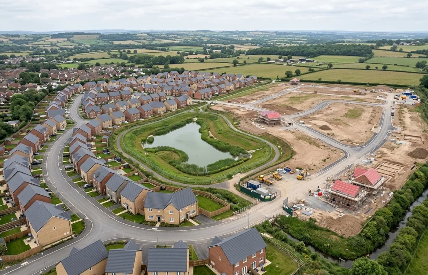
An urban extension that has run for years
The eastern side of Tiverton has been under sustained development for a long time now, in phases, with infrastructure going in ahead of housing in places and behind it in others. Sites like that accumulate history: a spine road built to one level, a drainage basin formed to another, a phase boundary that moved twice.
A dated aerial record is worth more on a site with that kind of history than on a clean greenfield plot, because half the questions that come up later are about sequence. What was formed by when, what level was it at, where did the temporary access run before the permanent one opened.
Two very different pieces of ground
The town sits where the Exe and the Lowman meet, with steep valley sides to the west and much gentler farmland east towards the motorway. Those two halves fly differently. A steep valley site needs the flight height set against the highest ground, not the lowest, or the resolution across the site varies more than the client expects.
The gentler eastern ground is close to ideal for mapping: open fields, low hedge density by Devon standards, and long uninterrupted sight lines. It is one of the easier places in the county to get a clean terrain model over a large area.
The parkway and the main line
Tiverton Parkway sits out on the main line east of the town, and the corridor around it carries employment land and logistics as well as the station itself. Rail-adjacent work is its own discipline: flights near an operational railway have to be planned with the line's controller, and that is arranged well ahead rather than on the day.
For anything in that corridor, the useful early question is how close to the boundary fence the survey actually needs to go, because the answer changes the paperwork more than it changes the flying.
Wool town stock in the middle
The centre keeps its wool-town inheritance: a mixture of ages, some substantial nineteenth century buildings, a castle and a canal basin, and plot patterns that were set long before anyone drew a site layout. Recording an existing building in that context is model work rather than map work, and the flight has to get round the back of things.
Base to Tiverton is about half an hour up the A396 or the motorway, so it comfortably sits inside a single visit even when a job needs both a block survey and a set of oblique passes over a structure.
The canal, and other long thin subjects
The Grand Western Canal runs east out of the town as a linear feature eleven miles long, and linear assets of that kind are one of the clearest arguments for aerial capture. A towpath, an embankment, a bank line or a hedge boundary running for miles is slow and expensive to survey on foot and quick to fly.
Corridor work is flown as strips along the alignment and processed as one continuous dataset. Where the subject is a bank or an embankment rather than flat ground, angled passes go in alongside the straight down grid so the face is recorded as well as the crest.
Behind the survey
What is behind a Tiverton mapping flight
CAA registered operator
Operator ID and Flyer ID held, which is the baseline anyone commissioning a flight over a live site should be asking to see before anything takes off.
A2 Certificate of Competency
The qualification that covers flying closer to people and property than the open default allows, which is what a built up site or a town centre survey needs.
100 megapixel Hasselblad camera
On a DJI Mavic 4 Pro. Resolution is the whole argument on a mapping job: it decides whether a stitched site map shows a plot peg or a smudge.
Radiometric thermal camera
A DJI Mavic 2 Enterprise Advanced with a 640 by 512 thermal sensor, for the jobs where a site needs a heat reading alongside the map.
Insured with Coverdrone
Full commercial cover. Certificates go to your site team or your client before the visit if that is part of your process.
Written note within 48 hours
Every job comes with a written record of conditions, coverage and the limits of the data, not just a folder of files with no explanation attached.
Construction background
The surveyor came into this from building work rather than from photography, so a site brief about levels, access and programme lands without translation.
Nearby
Also covered around Tiverton
- CullomptonMotorway-corridor town with a garden village allocation beside it, flat Culm valley ground, and earthworks big enough to make volumes worth measuring.
- CreditonA market town among large Mid Devon landholdings, where the mapping work is as often a farm, an estate or a drainage catchment as it is a building plot.
- ExeterThe busiest source of mapping work in the region, with land coming forward on every edge of the city and an airport control zone over its eastern side.
- WellingtonA Blackdown Hills town with a large allocation on its northern side and a station being brought back, so corridor and platform work run side by side.
See the output formats
Request a mapping quote in Tiverton
Send the boundary and what the data is for. Sam Hembury will come back with a fixed price for the site and the next slot the weather suits.