Drone Mapping Services
Terrain models, contours and volumes
Surface and terrain models with contours, sections and cut and fill or stockpile volumes, for earthworks estimating and drainage design.
Not sure which files you need? Every output this produces is listed here, with what each one is for and what it does not measure.
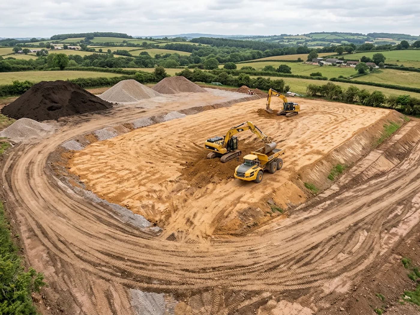
The same flight that produces a site map also produces height. Every point that appears in enough overlapping photographs gets a position in three dimensions, which is what a digital surface model is: a height for every visible surface, including buildings, vegetation, plant and stockpiles.
Strip the things that are not the ground out of that surface and you have a terrain model, which is what contours, sections and earthworks quantities come from. That distinction between the surface model and the terrain model is worth understanding before you commission, because the two answer different questions and a quantity taken off the wrong one is wrong by however much the vegetation was.
For anyone estimating muck shift, checking a stockpile against a delivery note or working up a drainage strategy, this is usually the part of a mapping job that pays for the flight.
What is included
- Digital surface model and digital terrain model, supplied as GeoTIFF rasters
- Contours at the interval you specify, exported as DXF or shapefile for CAD and GIS
- Cross sections and long sections through lines you nominate
- Cut and fill or stockpile volumes calculated against a base plane, a design surface or an earlier flight
- A short volume note setting out the method, the base surface used and what was excluded
- Repeat flights over the same site processed to the same setup, so two dates compare properly
Surface model, terrain model, and why the difference matters
A digital surface model includes everything the camera saw: the hedge, the site cabin, the excavator, the pile of pallets. A digital terrain model is the ground with those things taken out. Contours drawn from a surface model in a hedged Devon field will follow the top of the hedge, which is not where the ground is.
Removing them is a processing step with judgement in it, and it is more reliable on open, worked ground than under mature planting. On a bare development platform or a quarry floor the terrain model is close to the surface model anyway. Under a Devon hedge bank with twenty feet of growth on it, the ground underneath is inferred rather than measured, and the note that comes with the files says so.
Comparing two dates
Volumes are most useful as a difference. Flying the same site monthly through a cut and fill operation gives you a running quantity that does not depend on anyone standing in a haul route with a staff.
For the comparison to mean anything, both flights have to be processed the same way and tied to the same reference. That is straightforward when it is planned from the first visit, and awkward when the first visit was flown by someone else with no record of how it was set up, so it is worth deciding early whether a site is going to be monitored or mapped once.
On the day
How a terrain and volumes runs
- Step 1
Decide what the heights are for
Estimating, progress monitoring, drainage or a design surface comparison all want a different contour interval and a different level of tidying, so this is settled first rather than after processing.
- Step 2
Fly for height, not just coverage
Height work wants more overlap and a set of oblique passes as well as the straight down grid, particularly around steep faces, benches and stockpile toes where a straight down view alone leaves gaps.
- Step 3
Build the surface
The imagery is processed into a dense point cloud and a surface model, then the classified ground points are used to build the terrain model underneath it.
- Step 4
Take off the quantities
Volumes are calculated against whichever base you specify, with the method and the base surface written down alongside the figure rather than left implied.
- Step 5
Handover and comparison
Files, sections and the volume note go over within 48 hours. If this is a repeat visit, the comparison against the earlier date comes with it.
Behind the work
Kit, cover and qualifications
CAA registered operator
Operator ID and Flyer ID held, which is the baseline anyone commissioning a flight over a live site should be asking to see before anything takes off.
A2 Certificate of Competency
The qualification that covers flying closer to people and property than the open default allows, which is what a built up site or a town centre survey needs.
100 megapixel Hasselblad camera
On a DJI Mavic 4 Pro. Resolution is the whole argument on a mapping job: it decides whether a stitched site map shows a plot peg or a smudge.
Radiometric thermal camera
A DJI Mavic 2 Enterprise Advanced with a 640 by 512 thermal sensor, for the jobs where a site needs a heat reading alongside the map.
Insured with Coverdrone
Full commercial cover. Certificates go to your site team or your client before the visit if that is part of your process.
Written note within 48 hours
Every job comes with a written record of conditions, coverage and the limits of the data, not just a folder of files with no explanation attached.
Construction background
The surveyor came into this from building work rather than from photography, so a site brief about levels, access and programme lands without translation.
Terrain and volumes
Terrain models, contours and volumes questions
- Can you give a volume figure I can put in a tender?
- The method, the base surface and what was excluded are set out alongside the figure so you can see exactly what has been measured. What we will not do is attach an accuracy tolerance to it that the survey control on the site does not support.
- What contour interval should I ask for?
- Quarter metre or half metre suits most development platforms and earthworks. Wider intervals suit large rural sites and drainage catchments. If you are unsure, say what the drawing is for and we will suggest one.
- Will vegetation ruin the model?
- It limits it rather than ruins it. Open ground, hardstanding and worked platforms model well. Dense woodland and thick hedge banks do not, and those areas are flagged in the note rather than quietly smoothed over.
Where
Terrain models, contours and volumes across the South West
Also on this site
See the output formats
Request a mapping quote with Drone Mapping Services
Tell us the address and what you need looking at. Sam Hembury will come back with a fixed price and the next available slot.