Devon · EX39
Drone mapping services in Bideford
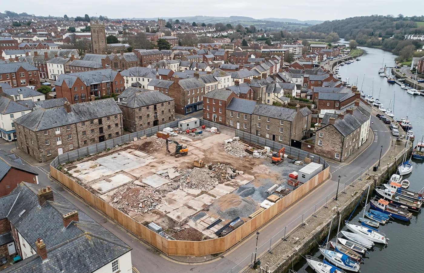
A Torridge port town with steep streets, a long bridge, working quays and industrial land east of the water, where relief and tide both shape the flight.
A working river town rather than a resort
Bideford still does actual port work, and that gives the survey subjects here a practical flavour: quays, yards, industrial units, hardstanding, storage areas and the ground behind them. Sites like these are usually about extent, levels and what is standing rather than about a landscape.
There is a steady flow of commercial and industrial work east of the water in particular, where larger plots and easier access make a survey a straightforward morning.
The town climbs, and it climbs hard
The western side of the town rises steeply from the quay, with narrow streets, stepped terraces and buildings stacked above each other. That relief has the same effect it does in Torquay and Totnes: a plan view carries very little of the information a designer needs, and the model does the work.
It also limits where an operator can safely launch and stand, which is worth resolving on a site visit rather than discovering on the morning of the flight.
Tidal water through the middle
The Torridge is tidal here and the difference between high and low water is substantial. Quay footings, slipways, the piers of the old bridge and the foreshore either side are all recorded at low tide, and nothing usable comes back from the water surface itself at any state of tide.
For anything involving the riverbank, the appointment is set by the tide table first and the diary second, which is a normal way to work on this coast and only awkward when it is left to the last minute.
Weather off the Atlantic
This coast takes weather straight off the Atlantic, and the practical effect is fewer settled flying windows through the winter than the south of the county gets. Wind is usually the limiting factor rather than rain.
Bideford is around an hour and a quarter from base. A job here is planned as a day, and it sits naturally alongside Barnstaple or Great Torrington when a client has work in more than one North Devon location.
Estuary industry and the ground at the mouth
Downstream of the town the estuary carries shipbuilding, industrial ground and the open dune landscape at Northam Burrows, and all three are large area subjects better flown than walked. Yards and industrial sites want extent and hardstanding condition; the burrows want a surface that can be compared with the same surface next year.
Sites at the estuary mouth are the most weather sensitive on this list along with Dawlish. Wind straight off the Atlantic decides whether a flight happens, and on this coast that is a fortnightly rather than daily proposition through the winter.
The compensation is that the ground here is open, low and easy to model once conditions allow, and a single visit covers a great deal of it.
In the old town itself, the Georgian merchant houses on the hill and the tightly packed cottages behind them are close, complicated subjects with very little room to stand back. Slate hanging on the exposed elevations, which exists here precisely because of the driving rain, is a good photogrammetric surface, textured and matt, and it models better than the rendered fronts around it.
Behind the survey
What is behind a Bideford mapping flight
CAA registered operator
Operator ID and Flyer ID held, which is the baseline anyone commissioning a flight over a live site should be asking to see before anything takes off.
A2 Certificate of Competency
The qualification that covers flying closer to people and property than the open default allows, which is what a built up site or a town centre survey needs.
100 megapixel Hasselblad camera
On a DJI Mavic 4 Pro. Resolution is the whole argument on a mapping job: it decides whether a stitched site map shows a plot peg or a smudge.
Radiometric thermal camera
A DJI Mavic 2 Enterprise Advanced with a 640 by 512 thermal sensor, for the jobs where a site needs a heat reading alongside the map.
Insured with Coverdrone
Full commercial cover. Certificates go to your site team or your client before the visit if that is part of your process.
Written note within 48 hours
Every job comes with a written record of conditions, coverage and the limits of the data, not just a folder of files with no explanation attached.
Construction background
The surveyor came into this from building work rather than from photography, so a site brief about levels, access and programme lands without translation.
Nearby
Also covered around Bideford
See the output formats
Request a mapping quote in Bideford
Send the boundary and what the data is for. Sam Hembury will come back with a fixed price for the site and the next slot the weather suits.